

Nearby Trails

Lake McGregor Circuit
Walk, run, MTB. Dogs prohibited.
E-Bikes but fence to lift over.
Cell phone coverage.
Distance: 4.6 km loop
Description: Easy open walking/biking across a mixture of farmland, 4WD track and road. From the highpoint you will be able to see three lakes: Tekapo, Alexandrina, and McGregor.
This trail is in a wildlife refuge and dogs or pets strictly prohibited. Keep an eye out for the rare Australasian crested grebes which breed and inhabit these lakes.
Please Note: This is an unmarked track but you can’t get lost. If biking, we suggest you go in an anti-clockwise direction. At certain times of the year the track below the Lake Alexandrina Rd can be underwater and/or fishermen are using the single track. Please be respectful and use the gravel road instead.
Getting there: From Tekapo, drive west on SH8 to Godley Peaks Rd - turn right onto and travel ~ 6.5 km, cross a bridge, and reach a cattle stop. Park on the left after the cattle stop and find a blue waratah to cross the fence. Walk west to the next blue waratah, cross the fence, and climb briefly on a sheep track above the lake. Follow the 4WD track past huts. Cross a foot bridge at the outlet, then walk by the stream or on the road back. Optionally, combine with the Lake Alexandrina Trail for a longer hike.

View of the Lagoon Trail looking south
Lagoon Trail and Frog Rock
Walk, run or MTB. Dogs prohibited
Distances
Lagoon Circuit – 8.5 km
Frog Rock Circuit – 3 km
Description: Lagoon Trail –8.5 km loop trail at Regional Park's southeast corner. Scenic farmland route in high country. Offers wide views, part gravel single track, part grass, part widened sheep paths. Some rocks to add fun to the valley section. Stunning lagoon at end for picnics.
Frog Rock – Named after the glacier's large erratic rock, this family-friendly trail offers stunning views of the Southern Alps and Mt Edward. Choose direction based on wind: nor’wester - terrace first; no wind - valley first.
Getting there: Walk/bike east from Tekapo township. Cross footbridge, follow lakeshore trail on Pioneer Drive towards Regional Park Info Panel. Veer right to small wooden park gate on Lilybank Road. Opposite gate, find unmarked uphill dirt track. Follow park fenceline on right to stile, e-bike gate with Lagoon Trail blue sign. Trail has blue waratahs and directional posts.
Lord of the Rings?
Want to feel like you're on the Lord of the Rings film set, or looking for an additional winter activity? The Tekapo Trails, Lagoon Track has just that! All the local trails are in excellent condition. Best time to go is after the frost melts - anytime from about 10am at this time of year. Take a snack, drink, and sun protection. Enjoy!

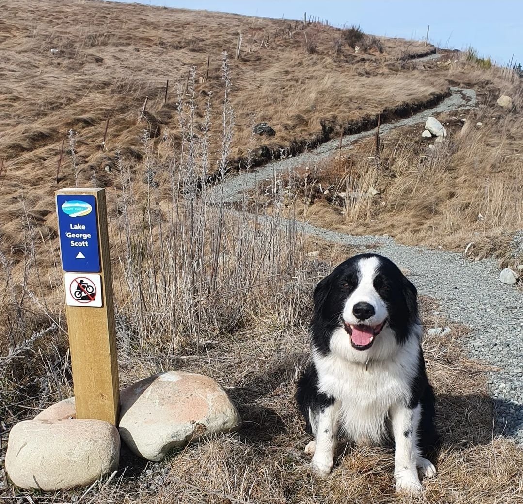
Lake George Scott -Powerhouse Road Circuit
Walk, run or MTB.
Distances:
Full circuit – 7.7 km
Description: This less-used road circuit is as interesting as the Mackenzie. Walk or bike beside the man-made kayak course, with or without water. Passing Lake George Scott, see the Lake Tekapo A power station, cross the dam and canals that attract fishermen. Do the full circuit or explore the kayak course and return up the gravel road. The start is part of the Alps 2 Ocean and Te Araroa Trails.
Getting there: Walk/bike from the Tekapo township, head west onto Aorangi Crescent, onto Andrew Don Drive until the road becomes gravel. Continue on the gravel road to the Canoe Course sign. Turn left to explore the kayak course loop or continue ahead to the Genesis gates. Continue through the bike gates along the canal to the bridge then head up the sealed road to SH8. At this intersection, there is Sams’s Track taking you above SH8 down to D’Archaic Drive past Peppers Resort and back into Tekapo township.


Lake Alexandrina
Walk, run, MTB. Dogs prohibited. E-Bikes but fences to lift over. Cell phone coverage.
Distance: 7.7 km one way to the top of the lake. The circuit is approximately 18.5 km.
Description: Predominantly flat, easy walking following a sheep track with magnificent views. Bikeable but single track and quite rocky.
This trail is in a wildlife refuge and dogs or pets strictly prohibited. Keep an eye out for the rare Australasian crested grebes which breed and inhabit these lakes.
Solid line on map: track ends at top of Lake. Dotted lines show public access on Unformed Legal Road (ULR) around lake. Trail not formed; swampy at top. Western side: 4WD tracks unmarked. Stay ≤40m near lake on ULR otherwise you are trespassing on private property, hindering Tekapo Trails' efforts.
Getting there: Drive west on SH8 from Tekapo to Godley Peaks Rd past Peppers Bluewater Resort. Turn right, drive for 4 km, turn left at farmgate, close gate, drive 2 km on gravel to huts and Lake Alexandrina. Park, walk lakeshore. Connect with Lake McGregor Trail for lake views and a longer hike.


